

Sands Landing, Crystal Lake: Commercial Land Photography and Lot Plans
Vacant land is the hardest thing in real estate to photograph, because the thing being sold is not there yet.
Sands Landing is 4.62 acres at Route 14 and Sands Road in Crystal Lake. Two commercial lots are for sale, plus a rail and stormwater buffer that conveys with them. Route 14 carries more than 25,000 vehicles a day past the frontage. The site is mown, flat and completely empty.
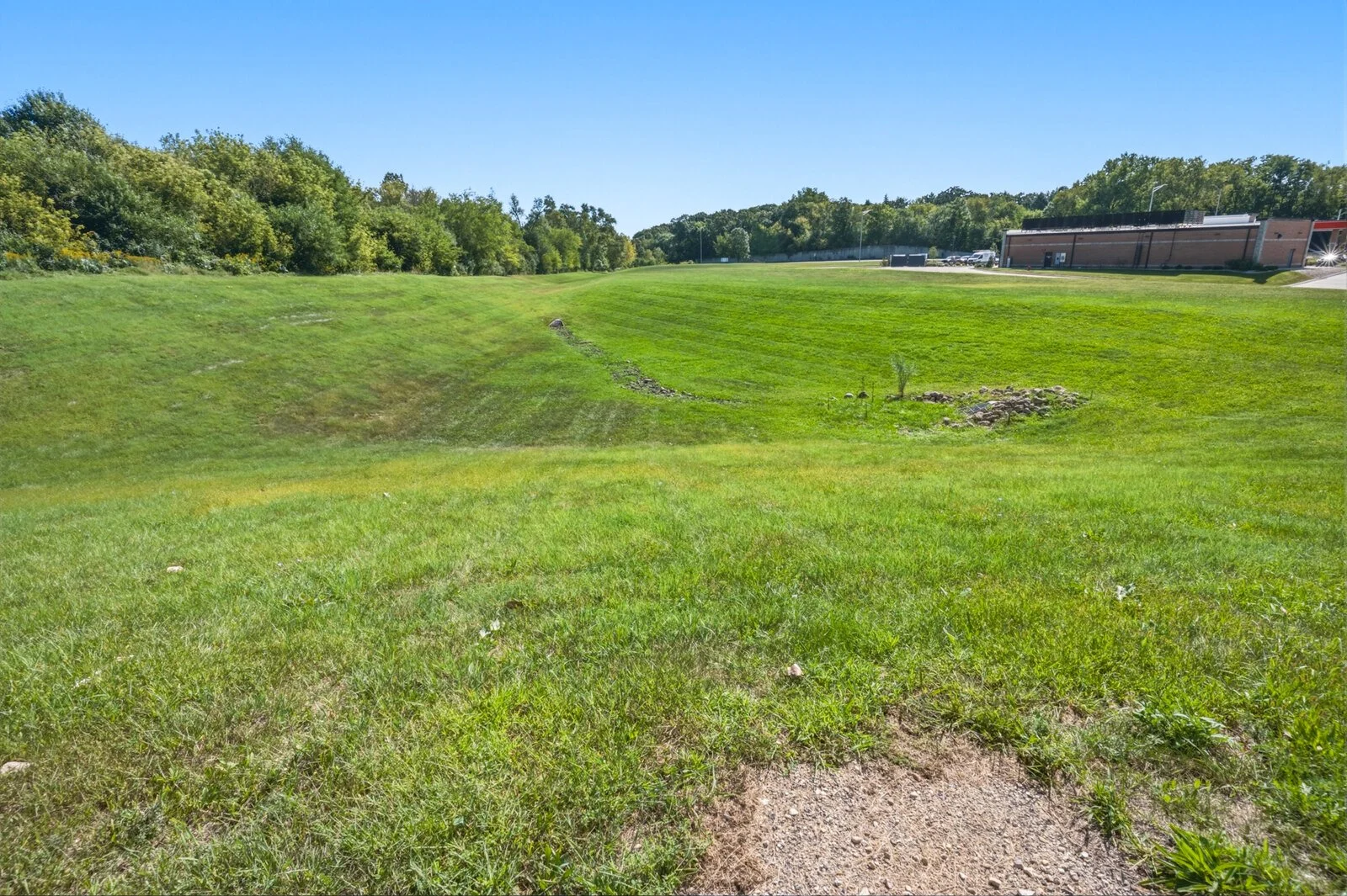
We shot it in September: aerials, plus a nineteen-frame ground walk covering the whole property. The gravel apron where the shared access drive currently ends, the internal drive, the Route 14 edge, and the detention basin with its graded side slope and stone outlet.
Good photographs of an empty field are still photographs of an empty field. So the real work was two other things.
Lot lines that are actually in the right place
A buyer looking at a drone photo of four acres cannot tell where one lot stops and the next begins. Hand-drawing the boundaries over the photograph was tried twice and failed twice. One version put part of Lot 2 over the highway pavement.
What shipped instead: the lot shapes were taken from the recorded Final Plat, then fitted to the photograph mathematically, using the road right-of-way measured in that same photo as a constraint. We checked it four ways. The lot shapes land within 0.32% of their recorded areas, the three lots combined within 0.12%, and holding one lot out of the fit entirely still put it on the correct ground.
That difference matters. A traced line is a guess that looks authoritative. A registered line is a drawing you can stand behind when a buyer’s engineer opens the plat.
Showing what fits, without pretending it is built
We then staged the site: a multi-tenant retail strip with a drive-thru outlot on the Route 14 frontage, and a smaller office and flex building on the interior lot. Both hold real landscaping, because both lots are capped at 75% impervious coverage, and a rendering that ignores that is selling a building nobody can get approved.
Everything in them is generic. No signage, no lettering, no brand marks, nothing implying a tenant.
The staging was generated full frame, then only the lot interiors were composited back onto the original photograph. Everything outside the lot lines, including the sky, the highway, the rail line and the neighbouring buildings, is pixel-identical to what the camera recorded. Verified, not assumed.
Every rendering carries ARTIST’S RENDERING, PROPOSED DEVELOPMENT, NOT BUILT burned into the image, and the unaltered photographs ship in the same folder. A buyer should always be able to see the ground as it actually is.
What was delivered
Thirty files, flat and numbered: 11 aerial photographs, 12 ground photographs, 3 lot identification maps, the recorded plat colour-coded, and 3 artist’s renderings.




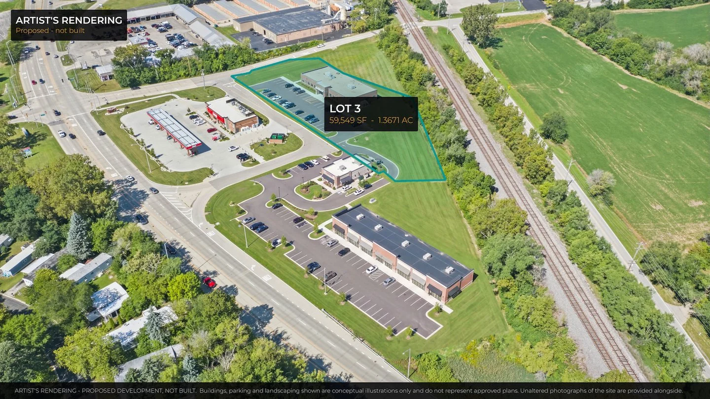
Lot 2 is 1.57 acres with the Route 14 frontage. Lot 3 is 1.37 acres behind it. Listed by Jeffery Padesky, JP Group at Real.
Ogi Optics shoots land media, aerial photography, lot plans and virtual staging across Chicagoland, out of Mount Prospect. See what a shoot costs, or get in touch to talk about a site.